Information Technology
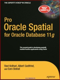
Pro Oracle Spatial for Oracle Database 11 g
Organizations are discovering with increasing frequency that the vast majority of their information assets have a spatial component, for example, the location of customers, shipments, facilities, personnel, competitors, and so on. The ability to use this information properly is fundamental to reducing operational costs, optimizing production efficiency, and increasing the quality of service. Evidence of the benefits that can be achieved by exploiting spatial information is plentiful, and many organizations are looking at ways of harvesting these benefits. We have been professionally involved in a variety of projects that introduced spatial information management into public and private organizations. The idea of writing this book came from these projects and from discussing spatial information management with the software developers and architects involved in them. We noticed a clear gap between the knowledge and skills necessary for successful spatial information management projects and the common background of the tech- nical personnel usually involved in large IT and database developments. The vast majority of these staff members had backgrounds in such diverse areas as database technology, Java, C++, PL/SQL, data models, security, availability, and scalability. However, only a small number had some experience with spatial data—for most, working with spatial data was completely new. It was easy to discover that spatial objects, geocoding, and map projections, for example, were foreign terms to most (and, of course, spatial information management is not about processing signals from space probes). Tools such as Google Maps and Google Earth have introduced few of these concepts to a large audience, but the majority of spatial technology still remains an esoteric subject.
Availability
No copy data
Detail Information
- Series Title
-
-
- Call Number
-
-
- Publisher
- : ., 2007
- Collation
-
1-823
- Language
-
English
- ISBN/ISSN
-
978-1-59059-899-3
- Classification
-
NONE
- Content Type
-
-
- Media Type
-
-
- Carrier Type
-
-
- Edition
-
-
- Subject(s)
- Specific Detail Info
-
-
- Statement of Responsibility
-
-
Other version/related
No other version available
File Attachment
Comments
You must be logged in to post a comment
 Computer Science, Information & General Works
  Philosophy & Psychology
  Religion
  Social Sciences
  Language
  Pure Science
  Applied Sciences
  Art & Recreation
  Literature
  History & Geography